Sun, 10/26/2025; 36 miles, 2861 feet of climb
——
Another great day biking the Southern Tier — that’s two in a row! Like yesterday, today featured perfect weather with no wind. Unlike yesterday, or any day yet, today also featured mountain passes.
——
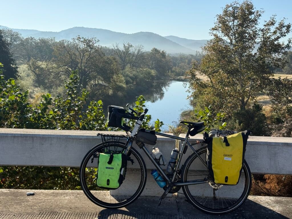
The day began with a long, slow climb out of Camp Wood. The incline was only 1-2%, so it was hardly noticeable, other than riding in a lower gear in the rear derailleur.
The weather was once again delightful. It started at 55°F and within an hour the sun warmed me up enough that I stopped to take off my gloves and raincoat.
I was thinking, hey, this day of climbing 2300 feet might not be so bad.
——
Then I hit it — my first Mountain Climb since New Mexico some 600 miles ago. Complete with switchbacks, hairpin turns with guard rails, and amazing views.
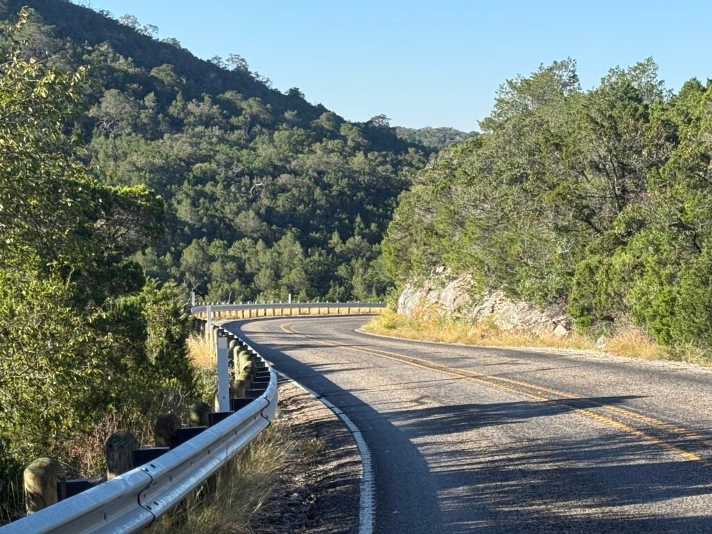
I was thrilled that I was still on the bike for the first sustained 8% climb, thanks to the new super-low “granny gear” installed by Eric at Spring Street Sports in Chippewa Falls.
However, the road was so narrow and the curves so tight that when I heard a car approaching from behind, I got off the bike to lean over to let him pass. Sometimes it’s hard not to weave a bit when climbing a steep hill, so this seemed safer.
My new dilemma: I couldn’t figure out how to remount a bike on an 8% grade. I just couldn’t get enough momentum.
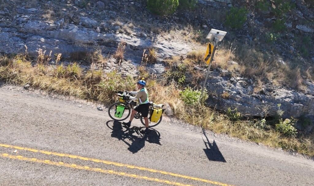
So, for the first time this trip, I waved the white flag and WALKED my bike up the hill. Good thing, too, as it got even steeper — up to 10.2%!
——
That climb went forever. When I finally watched the top, my overall average speed for the day sank to 7.2 mph. Yikes, this might be a long day.
Fortunately, it flattened out after that, and I resumed normal biking.
Then just before the halfway town, Leaky, I came upon a similar “mountain pass,” only this time I was going DOWN! I actually had to stop halfway down to let my brakes cool. These curves are too tight to get much speed up.
I also took advantage of the stop and swapped my cheesehead for the GoPro on top of my helmet, so I could get some video of the descent.
——
Just before Leakey, I stopped a a biker bar, the “Bent Rim Grill.” Lots of other bikers, but I was the only one pedaling. I got a great burger and a Coke, and used their WiFi since I’ve been cell hell again all day.

This was a great meal, since my breakfast was only beef jerky, Clif Bar, banana, and coffee. And I’ve already burned a lot of energy today, with another 15 miles and 1000 feet of climb to go.
——
Or so I thought. After Leakey, I had to climb another mountain pass that was equal to the first. My total climb for the day was 2861 feet, far more than any day other day of this trip.
But it was fun! I was glad that everything is working now and that there was hardly any wind again today.
——
I pulled into the Lost Maples RV Park and Campground around 3:30. The little convenience store closes at 5 PM, so I told them I’d be back after I got a campsite.
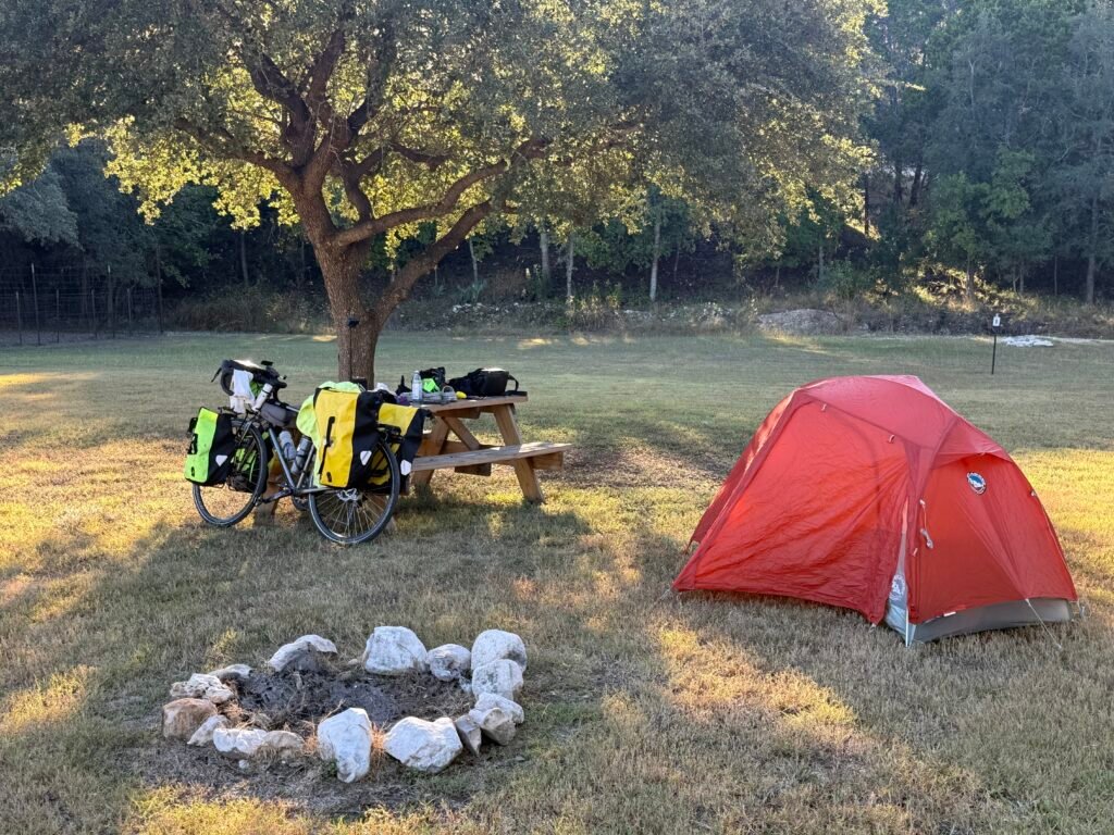
There was plenty of space for my small one-man backpack tent. In fact, I was the only tent in the whole place! And only two RVs, being a Sunday night. But it was a beautiful night for camping, and this place has WiFi.
I was in cell hell again all day today. As soon as I turned on the wifi, I saw an email message from Kayla at Foxfire cabins.
Foxfire is a place a few miles further that I saw on Google Maps. I had emailed them last night asking about price and availability. But when I arrived at the campground, I figure I’d better take a bird in the hand, since I couldn’t get her reply without cell coverage. Once I read her email via wifi, I replied to Kayla to apologize for not getting her message before booking the campsite.
I went back to the store to buy some chocolate milk for now and some snacks for the road, since there is nothing for at least 40 miles tomorrow.
Then a young lady walks into the store and looks at me and says, “Are you Tom?” Or was Kayla from Foxfire Cabins! She was just coming down to buy something and apparently noticed my bike out front.
——
I took a shower, washed my bike shorts in the sink, set up my tent, and cooked dinner. I finally used the dehydrated meal I’ve been carrying in my pannier for the last 450 miles.
It is a beautiful night with stars shining brighter than usual due to the lack of artificial lights in the Texas Hill Country. The only problem is that we are five weeks past the equinox, so it is dark before 7 PM! And it will stay dark for THIRTEEN HOURS.
But at least there is a picnic table, and I can update my blog by headlamp.
Tomorrow I had been planning to ride to the town if Hunt. But the locals said that town is wiped out from the awful floods this summer.
So instead I’ll probably have to ride to Kerrville. That will be a 51-mile day, but I actually should have a tailwind!
It’ll be my last day in the official Southern Tier route, as I will be diverting to San Antonio to stay with friends and with my son, and the going from ther to Austin to see my daughter and another son.
—————————————————-
TRANSLATIONS/BACKGROUND: “TEXBIRD” = Texas Bike Ride, my own nickname for the 800 miles in the middle of Southern Tier Bicycle Route, from El Paso to Austin, using maps from ACA (Adventure Cycling Association). This will complete my ride of the Southern Tier from the Pacific Ocean (San Diego) to the Atlantic Ocean (Jacksonville). (I biked the 1500 miles from Austin to Jacksonville in March 2024, and the 1000 miles from San Diego to El Paso in February 2025.)
—————————————————-
LINKS:
Old-fashioned BLOG if you have friends who don’t use Facebook:
“Old Scouter” Facebook page if you want to follow big adventures with more pictures and video clips (but not unrelated personal posts):
“Old Scouter” YouTube page (when I get time to edit after the trip):
It’s was a pleasure meeting you today Tom! Safe travels
Likewise, Kayla! I still can’t believe you called me by name in that convenience store…that was quite a surprise!